skip navigation link

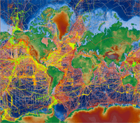
Screenshot of Bathymetry Viewer

Bathymetry and Global Relief

World Data Service for Geophysics


Bathymetry (Ocean Depths)

Bathymetric & Fishing Maps
Estuarine Bathymetry
Great Lakes
IHO Data Center for Digital Bathymetry (IHO DCDB)
International Projects for Ocean Mapping
Multibeam Data
NOS Hydrographic Survey Data
Paleobathymetry of the Circum-Antarctic
Trackline Data
US Extended Continental Shelf Project


Combined Bathymetry & Topography

Coastal Elevation Models
Coastal Relief Model (CRM)
Coastlines & Coastline Extractor
Global Relief (ETOPO1, ETOPO2, ETOPO5)


Topography (Land Elevations)

Lidar Archive