
NCEI's Marine Trackline Geophysical database provides single-beam bathymetry, subbottom profiles, magnetic, gravity, side-scan sonar and historic seismic reflection and refraction data collected during marine cruises from 1939–present. Data sources include U.S. and non-U.S. oceanographic institutions, universities, and government agencies with worldwide data coverage.
NCEI accepts underway geophysical data contributions on almost any media, preferably in the MGD77T Format. Please review our instructions for contributing non-MGD77T, such as subbottom profile and side-scan sonar data. NCEI accepts MAG88T Format for airborne magnetic surveys. To contribute data, please contact trackline.info@noaa.gov
Access Methods
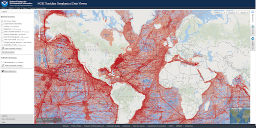
Trackline Geophysical Data Viewer
The Trackline Geophysical Data Viewer is an interactive map tool that can be used to search and access data by geographic area, survey year, survey name, institution, platform, date added to the database, and data type. Contact trackline.info@noaa.gov with questions.
Marine Geophysical Data Search
Browse the NCEI archive for water column sonar, multibeam bathymetry, trackline and National Ocean Service (NOS) hydrographic data.
Data Format and Structure
Data can be exported in the MGD77T Exchange Format, which contains a documentation header record and data records. Header records provide metadata for each survey. Data records contain geophysical data (bathymetry, magnetics, gravity, and seismic shot-point identification numbers) with time and position. MAG88T Exchange Format is used for airborne magnetic surveys, aeromagnetics, for reporting scalar or vector magnetic observations.
Ancillary, analog, and high-volume geophysical data, including subbottom profile, seismic reflection and refraction, and side-scan sonar, are available in industry standard formats (e.g. SegY, KEA, etc.). Historic analog data are also provided as scanned TIFF files. If you have questions about the legacy GEODAS software suite, please email trackline.info@noaa.gov.
Trackline Geophysics covers a wide variety of data types used to characterize the seafloor and subsurface, including the following data types:
- Bathymetry (Single Beam)
- Gravity
- Magnetics (including Airborne)
- Seismic Reflection
- (Multi- & Single-Channel)
- Seismic Refraction
- Shot-Point Navigation
- Side-Scan Sonar
- Subbottom Profile
 encompasses the U.S. Eastern Seaboard, Gulf of Mexico, Puerto Rico/U.S. Virgin Islands, and Hawaii.")

