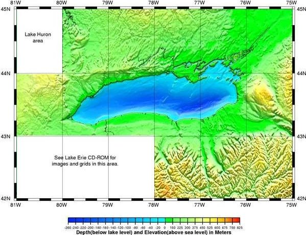
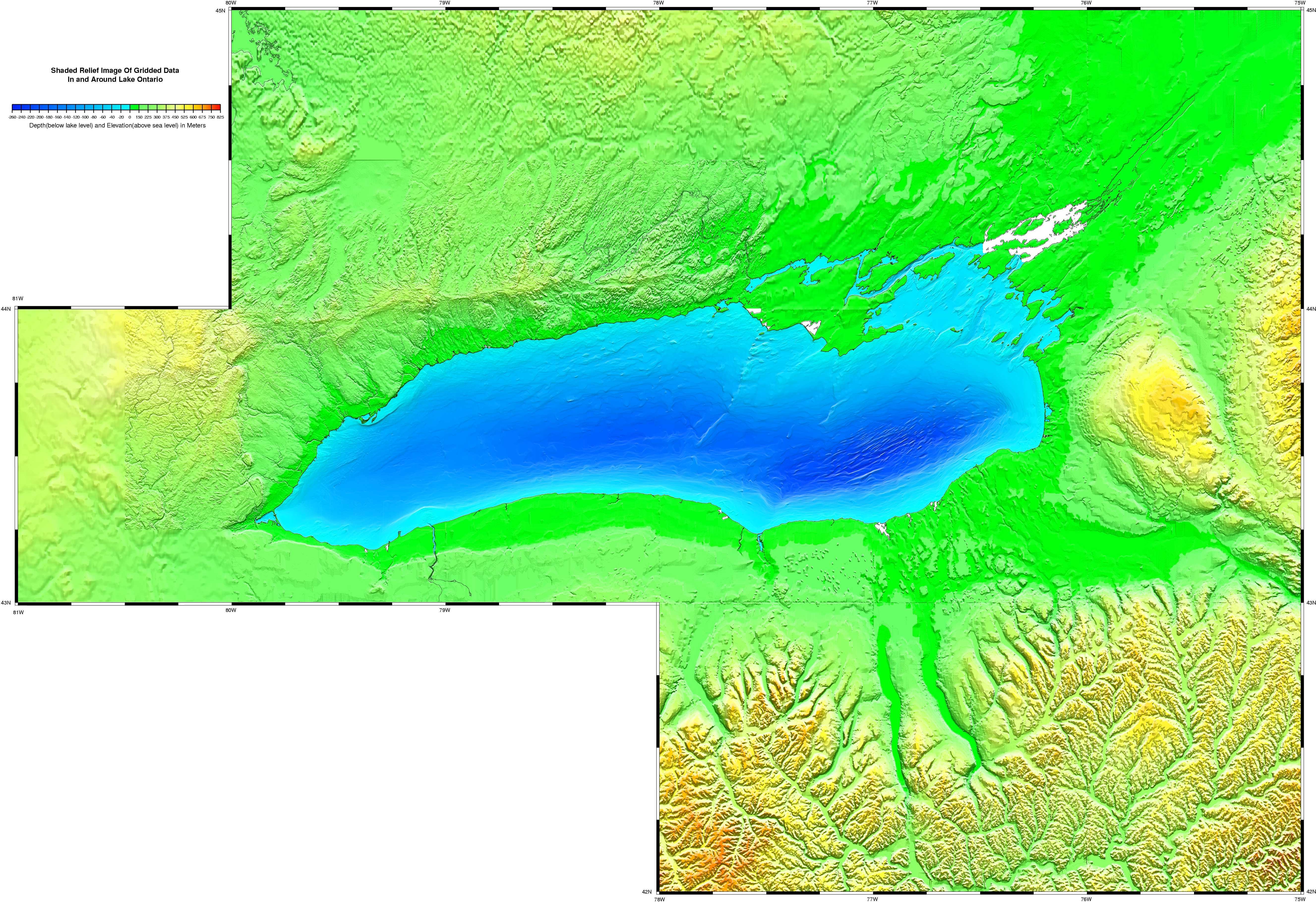
 Great Lakes Data Rescue Project - Lake
Ontario Bathymetry
Great Lakes Data Rescue Project - Lake
Ontario Bathymetry|
Although these data are of high quality and useful for planning and modeling
purposes, they do not necessarily reflect current conditions, nor do they
depict data which is on a nautical chart. For navigation please refer to
the NOS nautical chart series.
for shaded relief images or the Design a Grid data extractor) |
 |
A LARGE MAP(1.9 mb) version of the image above is also available for viewing. All of the Canadian topographic(land) pixels on these images bounded by 44N and 43.25N, 80.5W and 77.5W were generated from a Geological Survey of Canada(GSC) 30 meter gridded dataset. The 30 meter gridded data can be obtained from the GSC and other images were generated from this data by the GSC. All of the other areas on these maps were generated from the gridded data on this CD-ROM.