
NOAA > NESDIS > NGDC > HDGM
This website is being retired. Please check out our new website here https://www.ncei.noaa.gov/products/high-definition-geomagnetic-model
Images
 HDGM improvement in declination for Caspian sea |
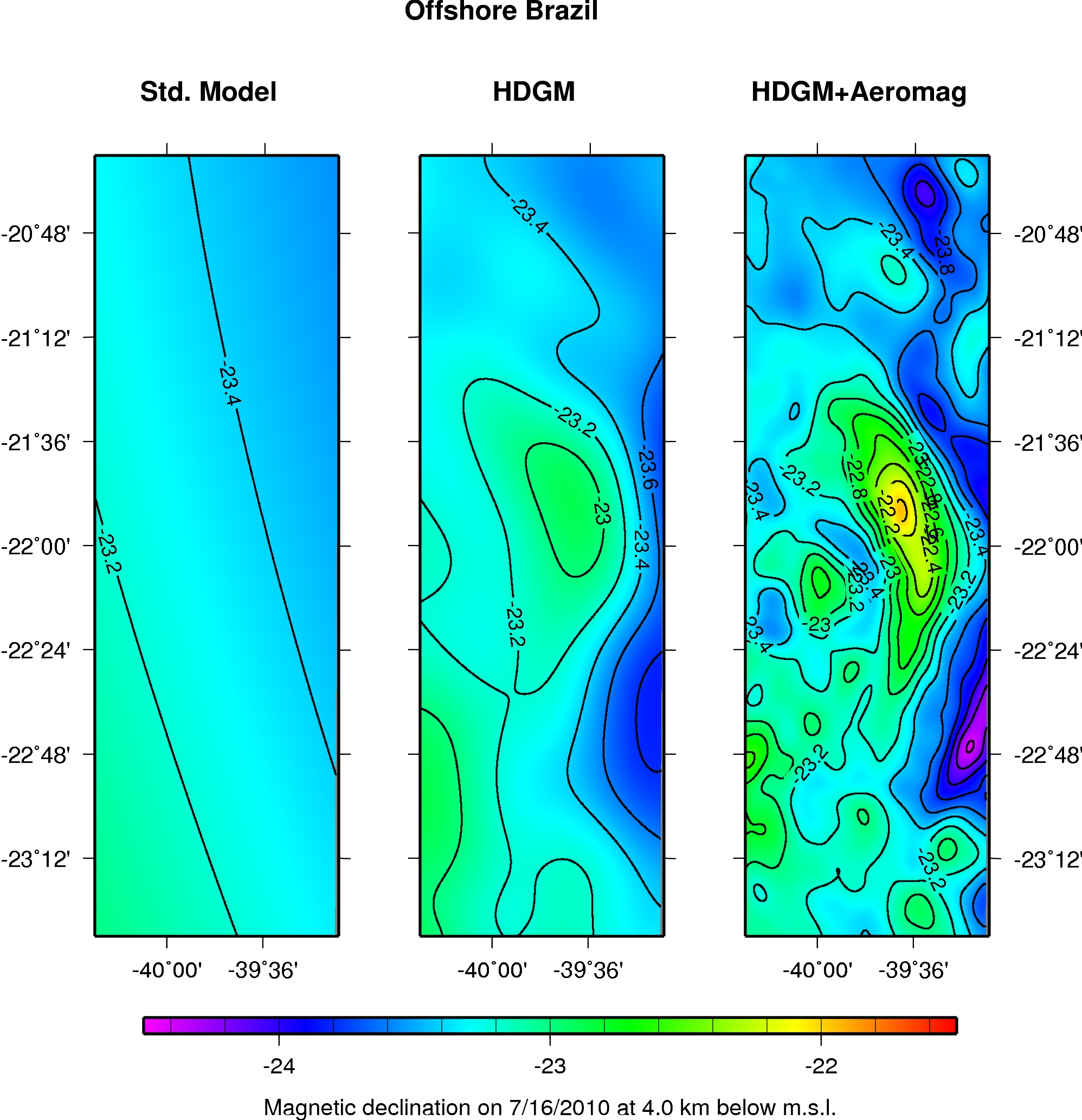 HDGM improvement in declination for off-shore Brazil |
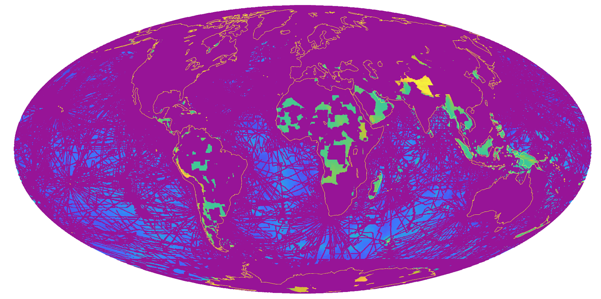 Map of high resolution data coverage. The purple areas indicate full model resolution of 28 km, based on coverage by ship and airborne magnetic surveys. Other areas have a reduced resolution of 133 km based on satellite data only. |