
|
< 5.A.ii. DEM for Australia
* Primary reference citation for all data from this source In 1996, NGDC and the Australian Surveying and Land Information Group (AUSLIG) signed an agreement to provide access to high-quality Australian elevation information for GLOBE. AUSLIG offered access to a data base of 5,190,624 point elevations, from which NGDC would derive a 30" gridded DEM for use in GLOBE. The original data base was proprietary to AUSLIG; the resultant DEM would be owned by AUSLIG and any other providers of data. AUSLIG would license the data to NGDC (now NCEI) for distribution with GLOBE. Inspection of the data base (AUSLIG, 1996) by NGDC (now NCEI) suggested that it consisted primarily of digitized contours from topographic maps, supplemented by coastlines, and point elevations. AUSLIG describes the data as follows (John Payne, AUSLIG, 1998, written communication): "The elevation data in the relief theme supplied by AUSLIG had been derived from AUSLIG’s published 1:100,000 scale topographic maps and unpublished 1:100,000 scale map compilation material. The elevation data are point elevations captured at an irregular interval spacing to best portray the terrain. The spot elevation feature contains either spot heights on the source material or points selected from contours. Spot heights are individual point elevations in the source material. They are generally located at local high points such as sand ridges, hills and mountain tops or at the low points in depressions. These points were observed directly by stereoplotter in the map production process."
The surface generation was run in GRASS, within a mask derived as follows. Kent Lethcoe of USGS's EROS Data Center provided a 30" gridded mask of oceans (derived from World Vector Shoreline [WVS]) and lakes (derived from Digital Chart of the World) vectors. Every 30" grid cell containing at least one point of zero or higher elevation in the AUSLIG point data base was added to the land area in this mask. AUSLIG notes (John Payne, AUSLIG, 1998, written communication) that: "In the AUSLIG data, all points which coincided with the coastline were derived by selecting representative points on the waterline feature in the framework layer, and assigning an elevation of 0 metres. Because the framework layer is 1:250,000 scale source data, their accuracy is considerably different to the rest of the elevation data contained in the relief theme. Zero values in the interior, and subzero elevations for Australia, are well inland around Lake Eyre." The land mask for Australia provided by USGS was enlarged to include all 30" grid cells containing point elevations in AUSLIG (1996). In so doing, we accepted the Australian source materials as adding detail to the land mask previously based only on WVS coastlines. Areas on land (not counting lakes and oceans) received interpolated elevations, where point elevations did not exist. The output interpolated elevations were the inverse-distance-weighted mean of the three closest point elevations. Elevations for each lake in the mask were taken to be the lowest DEM value around that lake. These were determined as follows. Lake areas were “spread” one grid cell into adjacent shore areas, using the GRASS function r.grow. The lowest elevation for each lake shore was determined by finding the lowest non-zero value in each of the “spread” lake areas. These lowest shoreline values were then assigned to their respective lakes as the highest water level that could be contained in the catchment area.
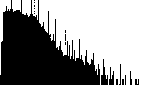
The spikes are more pronounced in the AUSLIG/NGDC DEM than in the DCW/USGS DEM, probably a result of the "minimalist" approach to interpolation and the relatively dense network of points in the AUSLIG source data set. Where a 30" grid cell had an elevation assigned from the AUSLIG source file, NGDC's procedure accepted that value. Since there are over five million source data points for ten million square km of Australia, slightly over half of the 30" grid cells were already assigned elevation values (usually in multiples of 20 or 50 meters). Local histograms are smoother in areas with coarser-spaced AUSLIG source points, where interpolated points are more numerous than source points. The contour interval is coarser in the DCW/USGS DEM, consistent with the coarser scale of the DCW source materials. Other assessments: Australia is unique in GLOBE Version 1.0. It has two DEMs: a completely unrestricted DEM derived (as described in Section 5.A.vii) from Digital Chart of the World contours, and a DEM derived by NGDC and licensed by AUSLIG from its source materials. Comparing the two DEMs to Operational Navigation Charts (ONCs, the source materials for DCW) yields some interesting features. For example, in South Australia, west of Port Augusta, the ONC graphically depicts (via shading patterns) a large dune field. However, the dune field has only a very modest influence on the topographic contours in that area, as the contour interval is rather course on ONCs. The DCW DEM almost completely misses the dune field. The AUSLIG DEM shows the dune field in good detail since contour intervals and supplemental point elevations are of sufficient resolution. However, individual dunes within the dune field, sketched (probably slightly stylistically) on the ONC, appear to be too subtle for the contour interval on the AUSLIG maps used to make the point data base. This suggests that the 30" GLOBE DEM is of appropriate resolution for the AUSLIG source materials.
|


Questions: dem.info@noaa.gov | |