Marine Seismic Reflection
USGS OFR83-593
L4-79-SC
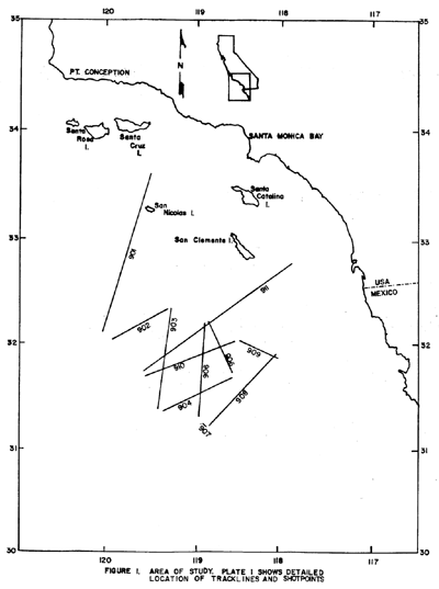
During the fall of 1979 the U.S. Geological Survey (USGS) collected approximately 1103 km. of 24 channel seismic-reflection data across the continental margin in the eastern Pacific Ocean off the California coast south of Point Conception. The profiles were collected on the USGS Research Vessel
S.P. Lee using a sound source of five airguns totaling 1326 in3. The recording system consisted of a 24-group streamer, 2400 meters long and a GUS (Global Universal Science) model 4200 digital recording instrument. Records were sampled at a 2-millisecond rate and later processed at a 4-millisecond rate. Navigational control for the survey was by satellite fixes augmented by Loran C (Rho-Rho) and Doppler-sonar bottom-track navigation. The seismic reflection records vary from 8 to 12 seconds in length depending on water depth and geologic structure.
|

|

