Versions Available
- 10 sheet set
(each 74 x 90 cm)
1:1,000,000 scale
at 38 deg. N
- Photo-reduction to
1:5,000,000 scale
- downloadable images
|
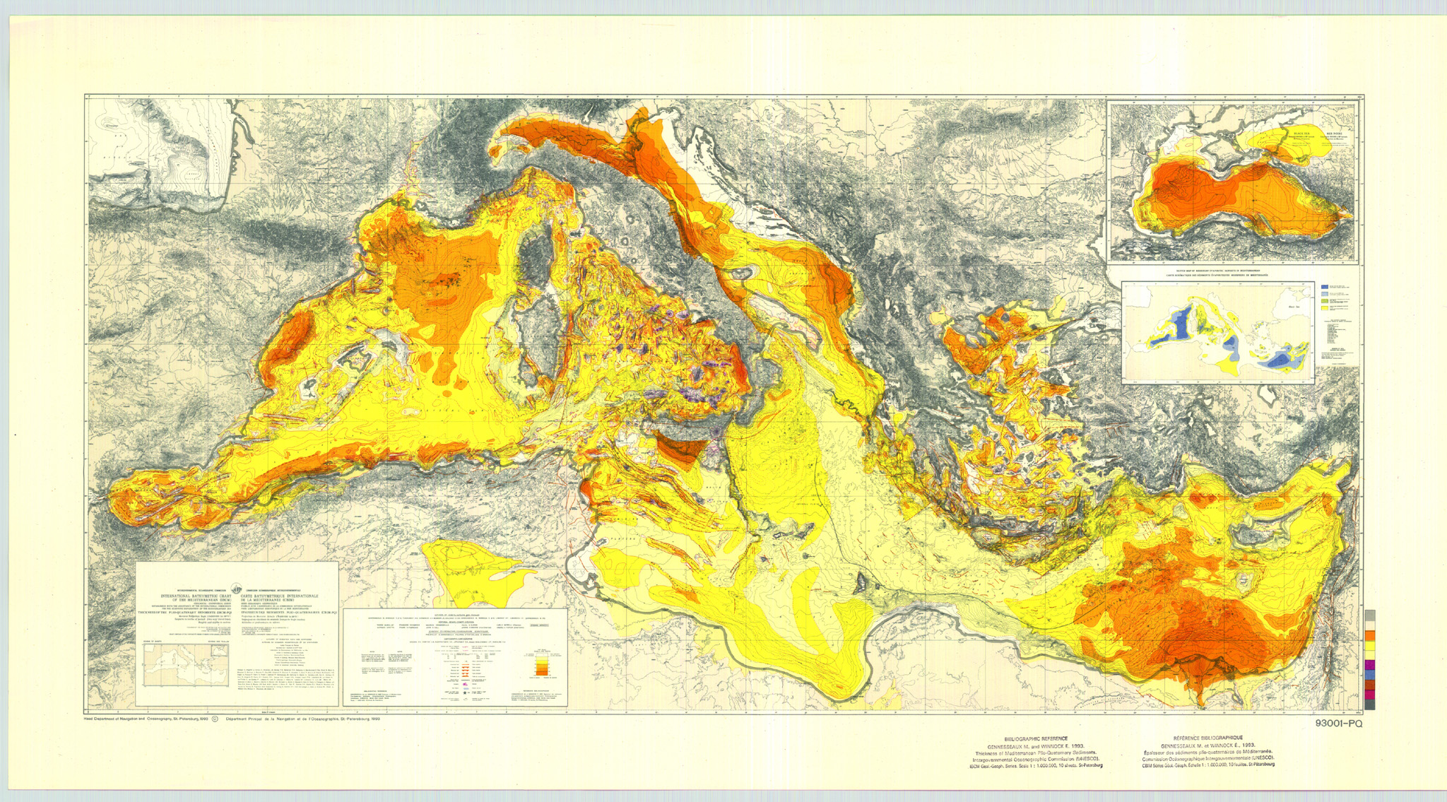
Plio-Quaternary Sediment Thickness Map (IBCM-PQ)
Information on ordering copies of IBCM maps
(and digital bathymetric contour data incorporated into the GEBCO Digital Atlas)

click on map above for a larger preview
This Plio-Quaternary sediment thickness map was compiled under the direction of P. Burollet, M. Gennesseaux, P. Kuprin, E. Tzotzolakis, and E. Winnock. It is published by the Charts Division of the Head Department of Navigation and Oceanography in Russia under the authority of the Intergovernmental Oceanographic Commission (IOC) of UNESCO. The primary data derive from numerous marine seismic surveys of the depth to the top of the Messinian salt layer, together with land compilations. Contours are in increments of 0.2 sec two-way travel time, with changes in tint at 0.2, 1.0, 2.0, and >30 sec.
The bathymetry is from 200 m contours of the original IBCM with supplemental 20 m, 50 m, and 100 m contours at sea. Explanations are in English and French, and tectonic, diapiric, and volcanic features are indicated. Inset is a sketch map showing the Messinian evaporite deposits in the Mediterranean.
Two versions are available; a 10 sheet set (each 74 X 90 cm) at 1:1,000,000 scale at 38 degrees N, and a photo-reduction to 1:5,000,000 scale. An explanatory brochure is in preparation.
|
 Return to IBCM Home Page