 Great Lakes Data Rescue Project - Lake Michigan Bathymetry
Introduction | Geomorphology | Raster data files | Vector data files | Images
Great Lakes Data Rescue Project - Lake Michigan BathymetryIntroduction | Geomorphology | Raster data files | Vector data files | Images

|
|
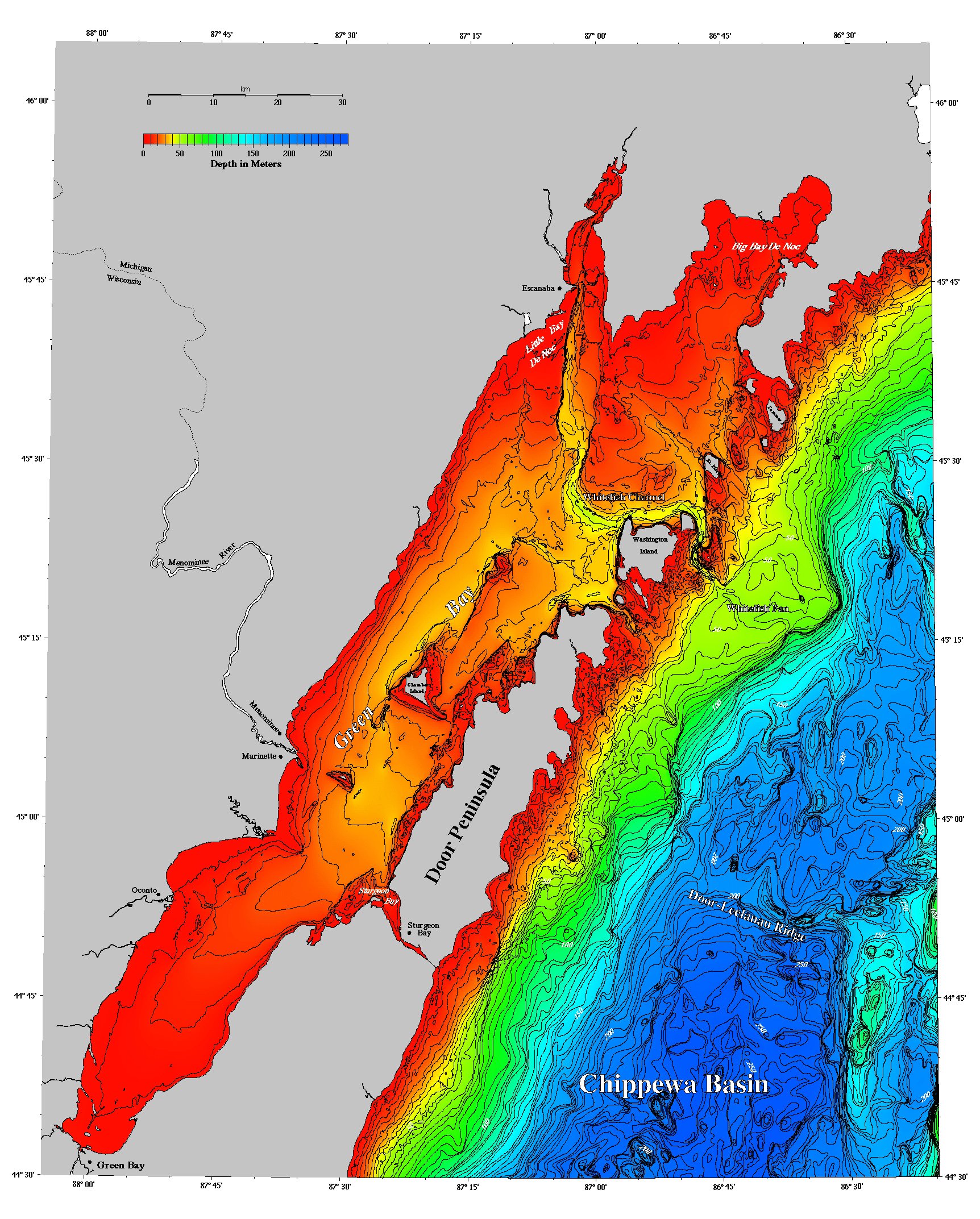
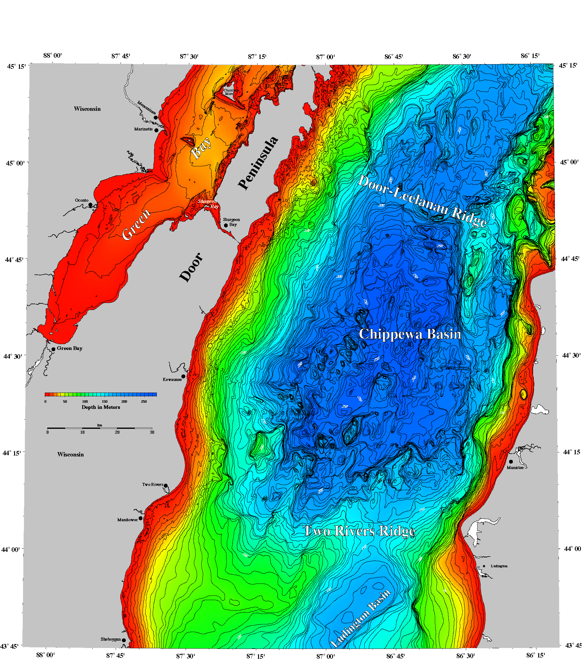
| Lake Michigan Bathymetry contour interval 25 meters images/lake.gif, 85 Kbytes |
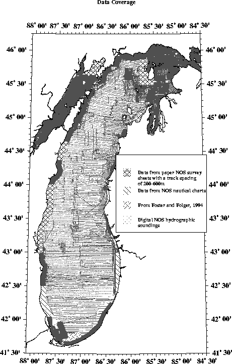
Lake Michigan data coverage images/data.gif, 20 Kbytes |
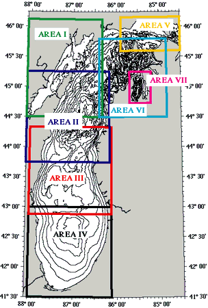
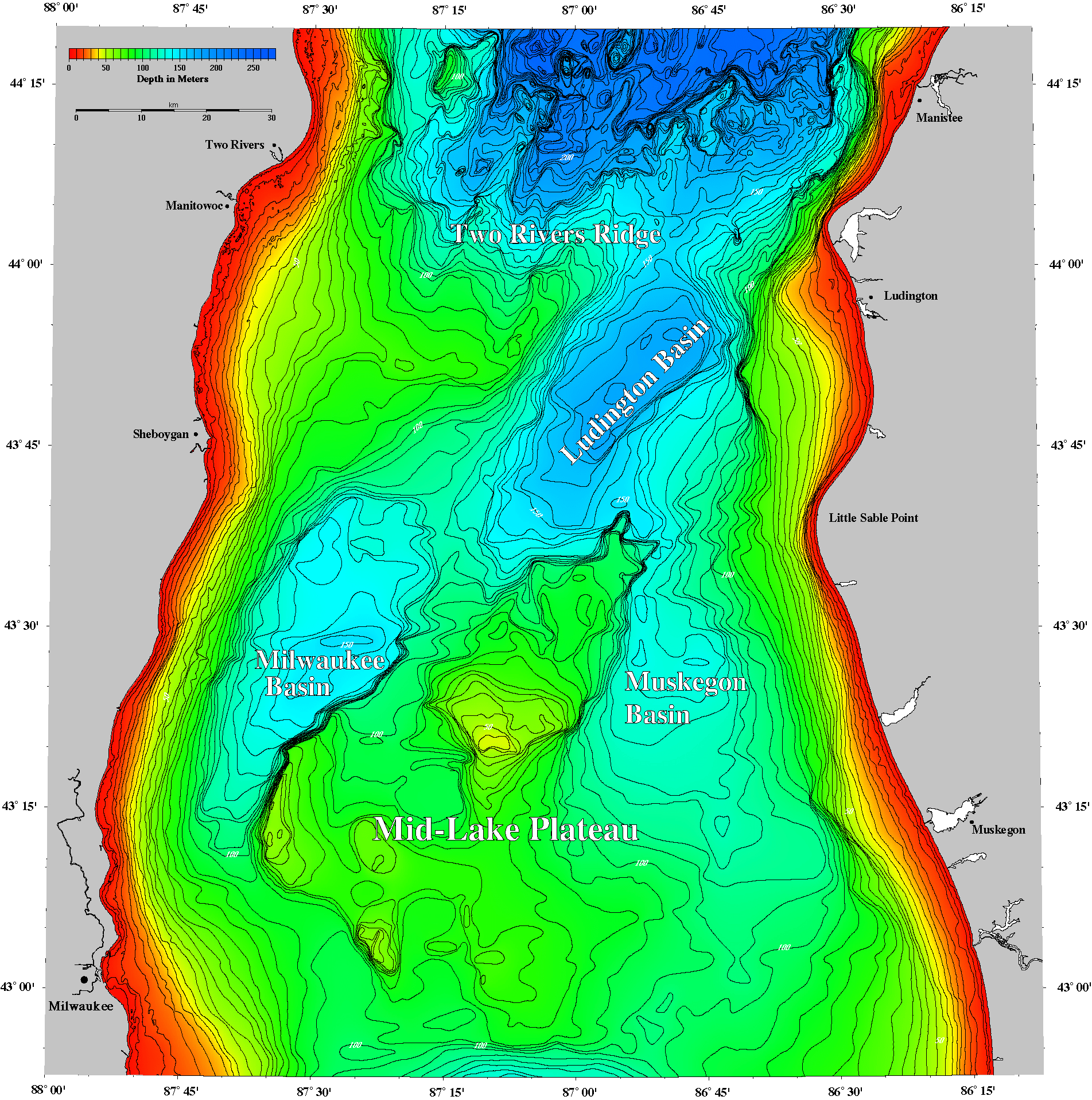
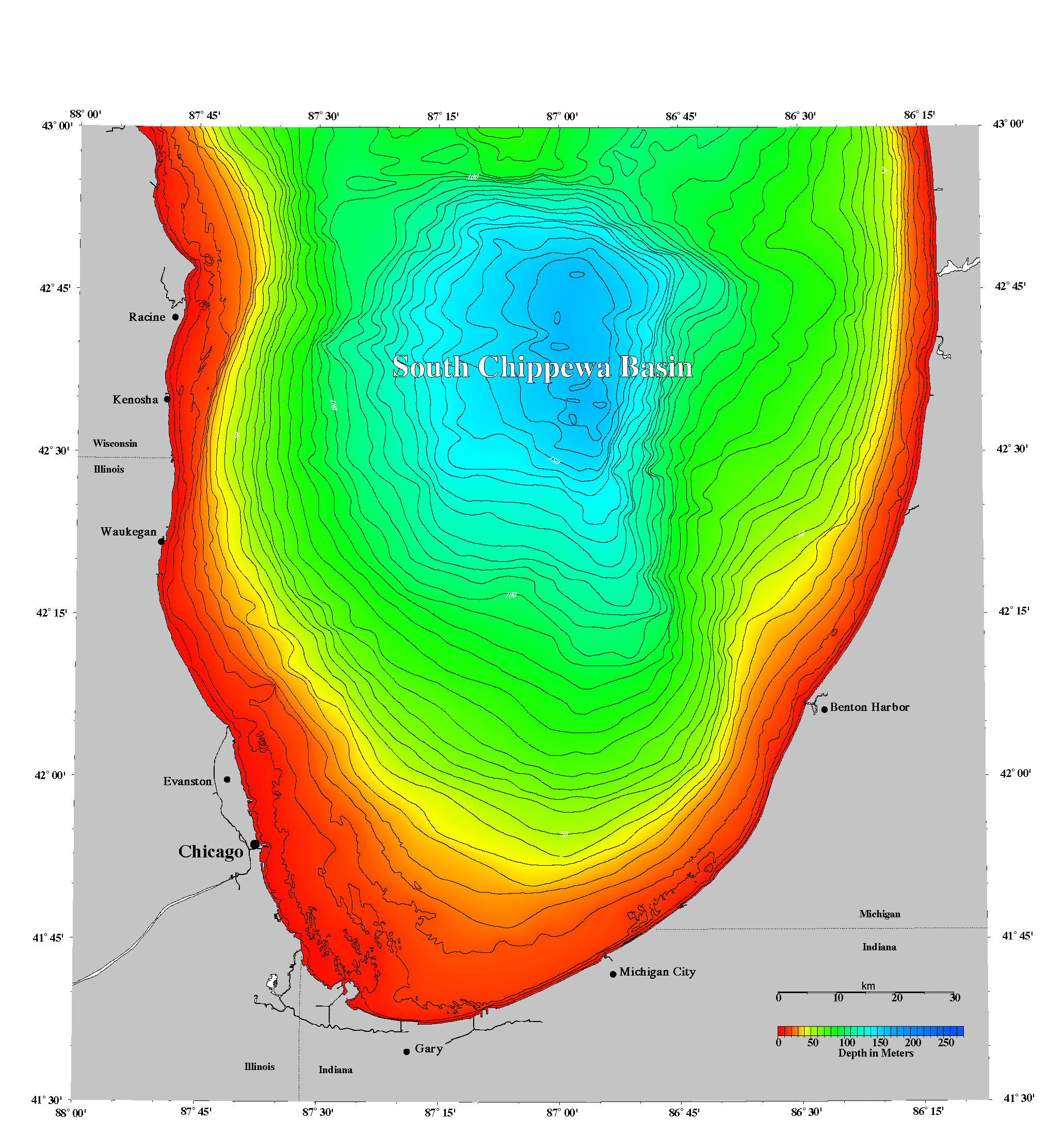
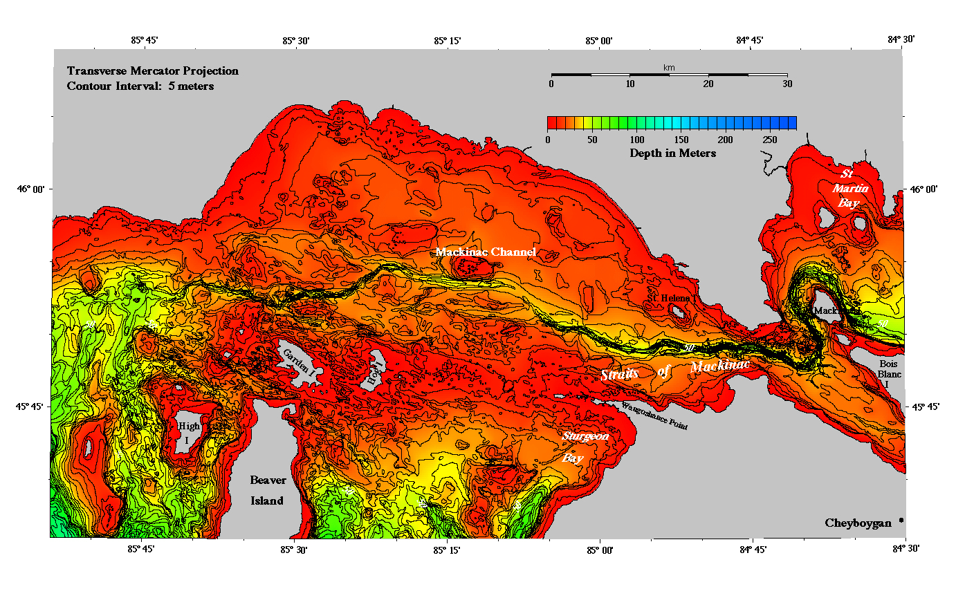
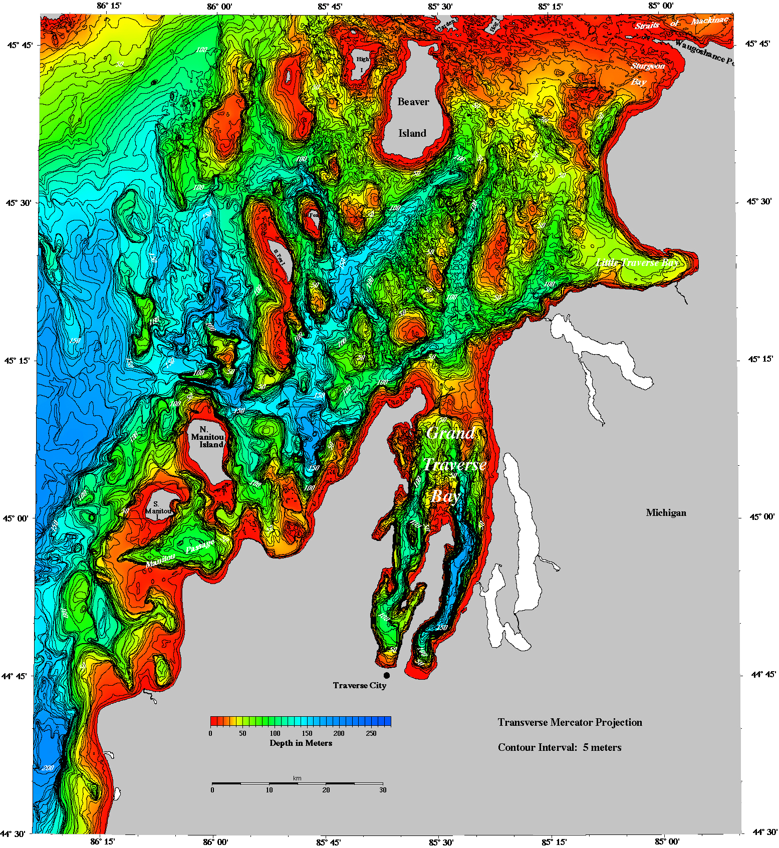
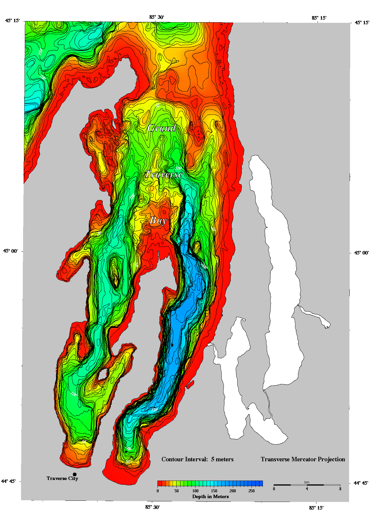
Two resolution images are available for each of the seven areas below. Choose to view a page size image with a contour interval of 10 meters or a full size image with a contour interval of 5 meters (these are large and may take a while to load)
| Resolution | file name | size (Kbytes) |
| AREA I | ||
| Page size | images/area1lo.gif | 90 |
| Full size | images/area1hi.gif | 1201 |
| AREA II | ||
| Page size | images/area2lo.gif | 132 |
| Full size | images/area2hi.gif | 1463 |
| AREA III | ||
| Page size | images/area3lo.gif | 134 |
| Full size | images/area3hi.gif | 1403 |
| AREA IV | ||
| Page size | images/area4lo.gif | 117 |
| Full size | images/area4hi.gif | 1316 |
| AREA V | ||
| Page size | images/area5lo.gif | 59 |
| Full size | images/area5hi.gif | 366 |
| AREA VI | ||
| Page size | images/area6lo.gif | 113 |
| Full size | images/area6hi.gif | 1131 |
| AREA VII | ||
| Page size | images/area7lo.gif | 149 |
| Full size | images/area7hi.gif | 542 |
GMT (Generic Mapping Tools) was the primary software package used to create these images. JPEG and EPS files are also available for most images and may be found in the images/jpeg and images/eps directories respectively on the CD-ROM. GIF files are in the images and html directories on the CD-ROM.
Introduction | Geomorphology | Raster data files | Vector data files | Images