 Great Lakes Data Rescue Project
- Lake Erie and Lake Saint Clair Bathymetry
Great Lakes Data Rescue Project
- Lake Erie and Lake Saint Clair BathymetryIntroduction | Geomorphology | Grids | Vector data files
 |
 |
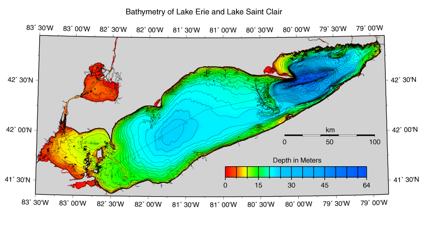
| Lake Erie and
Lake Saint Clair Bathymetry
images/le.jpg, 289 Kbytes |
Lake Erie
and Lake Saint Clair Data Coverage
images/dat.jpg, 167 Kbytes |
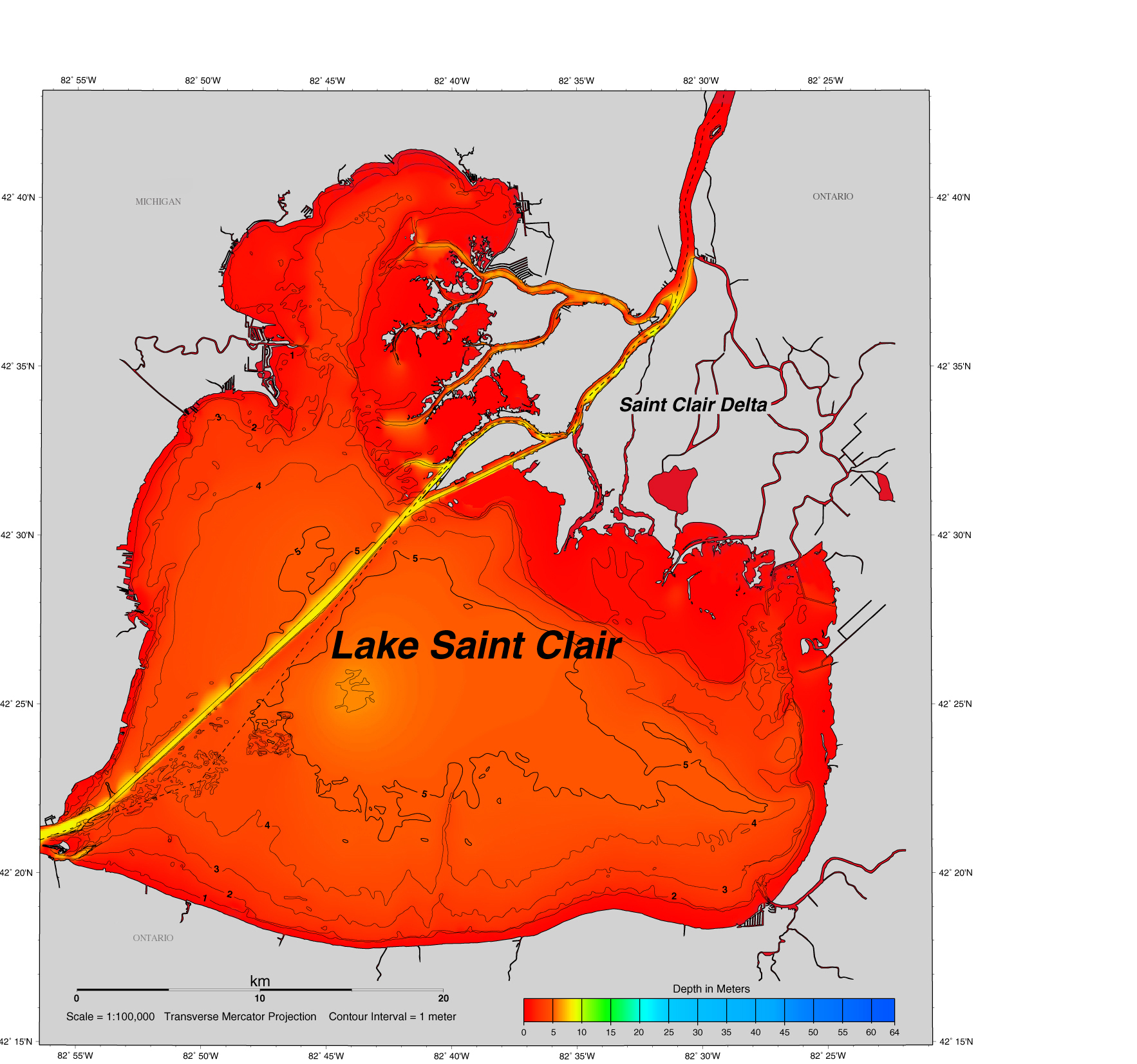
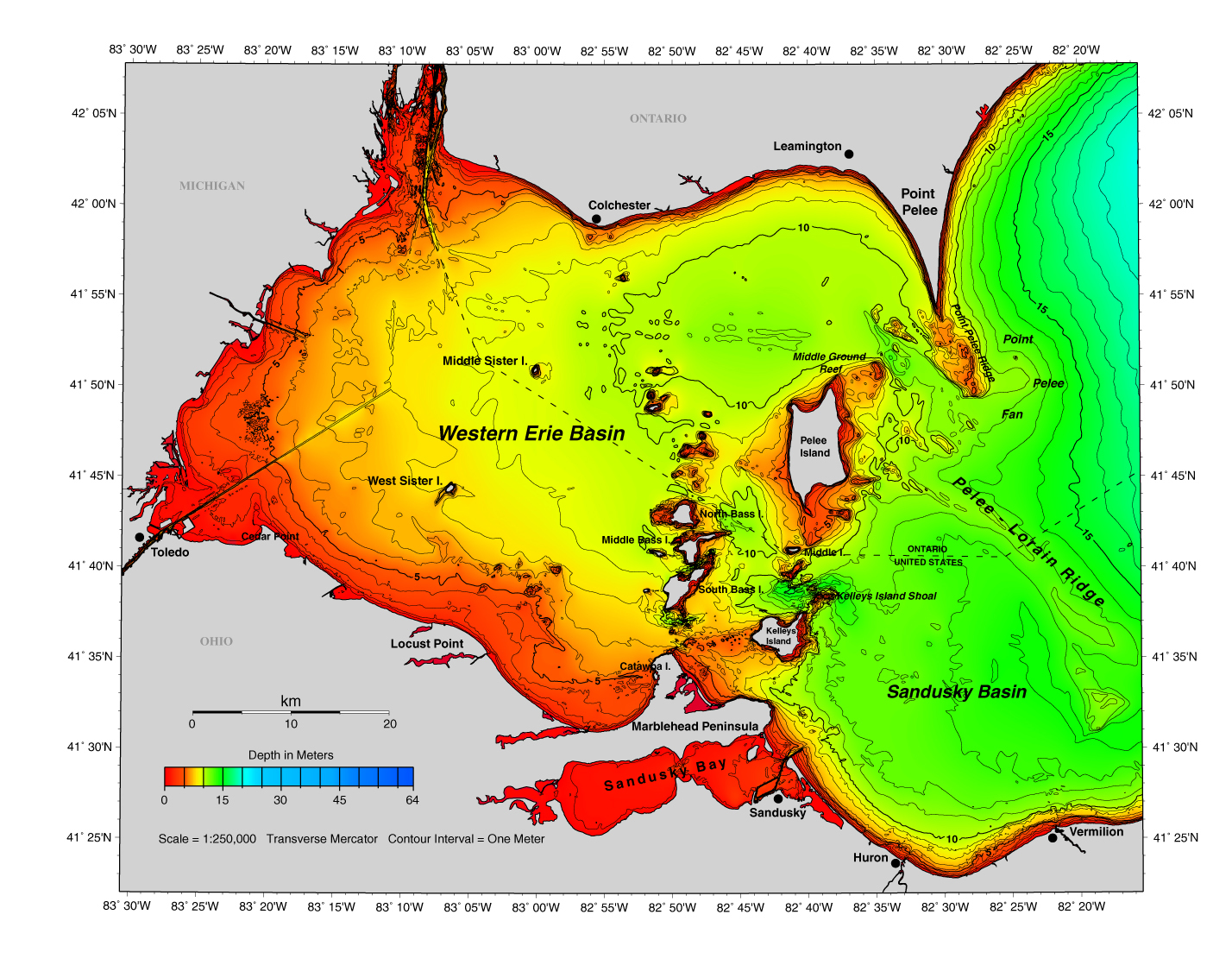
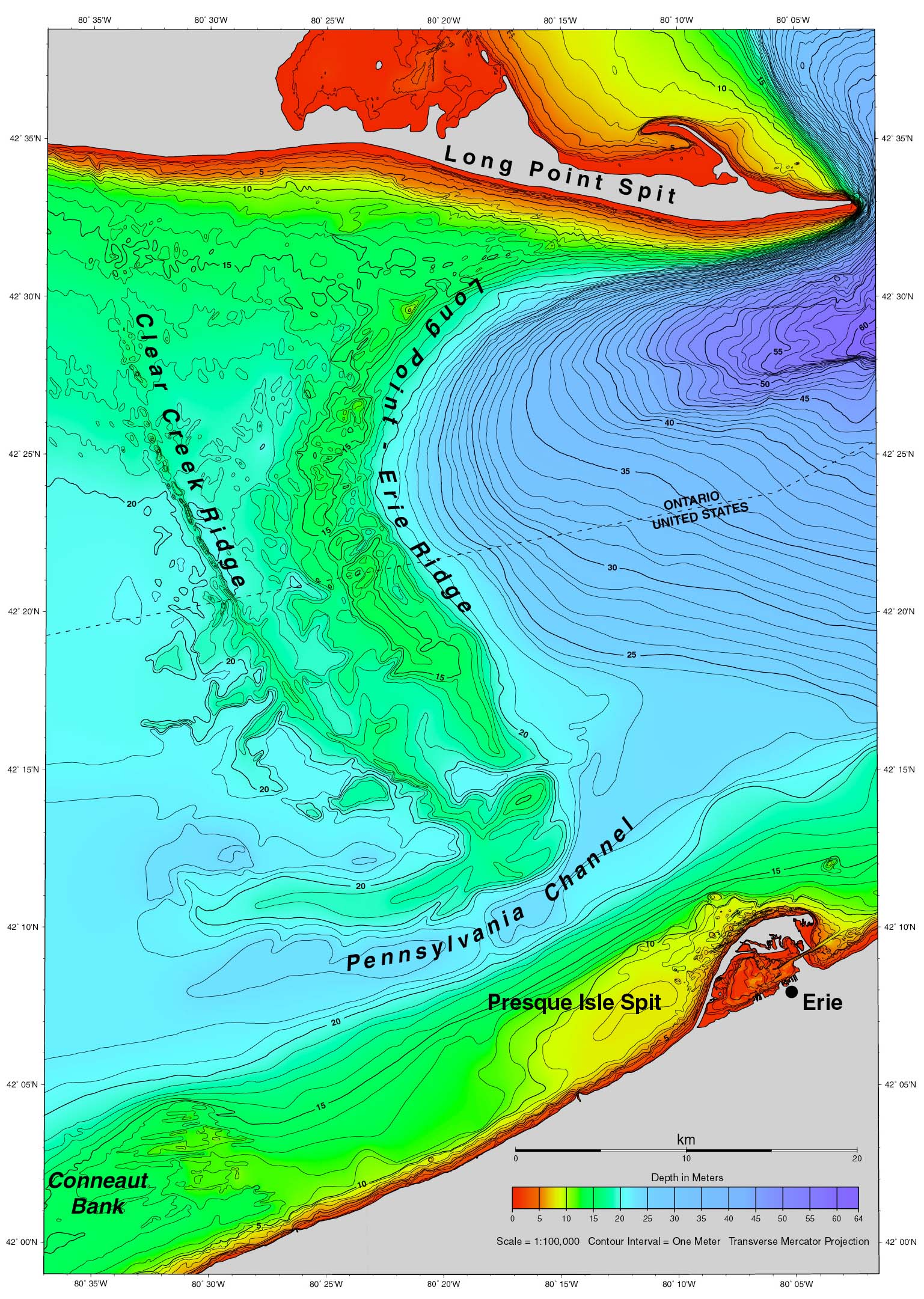
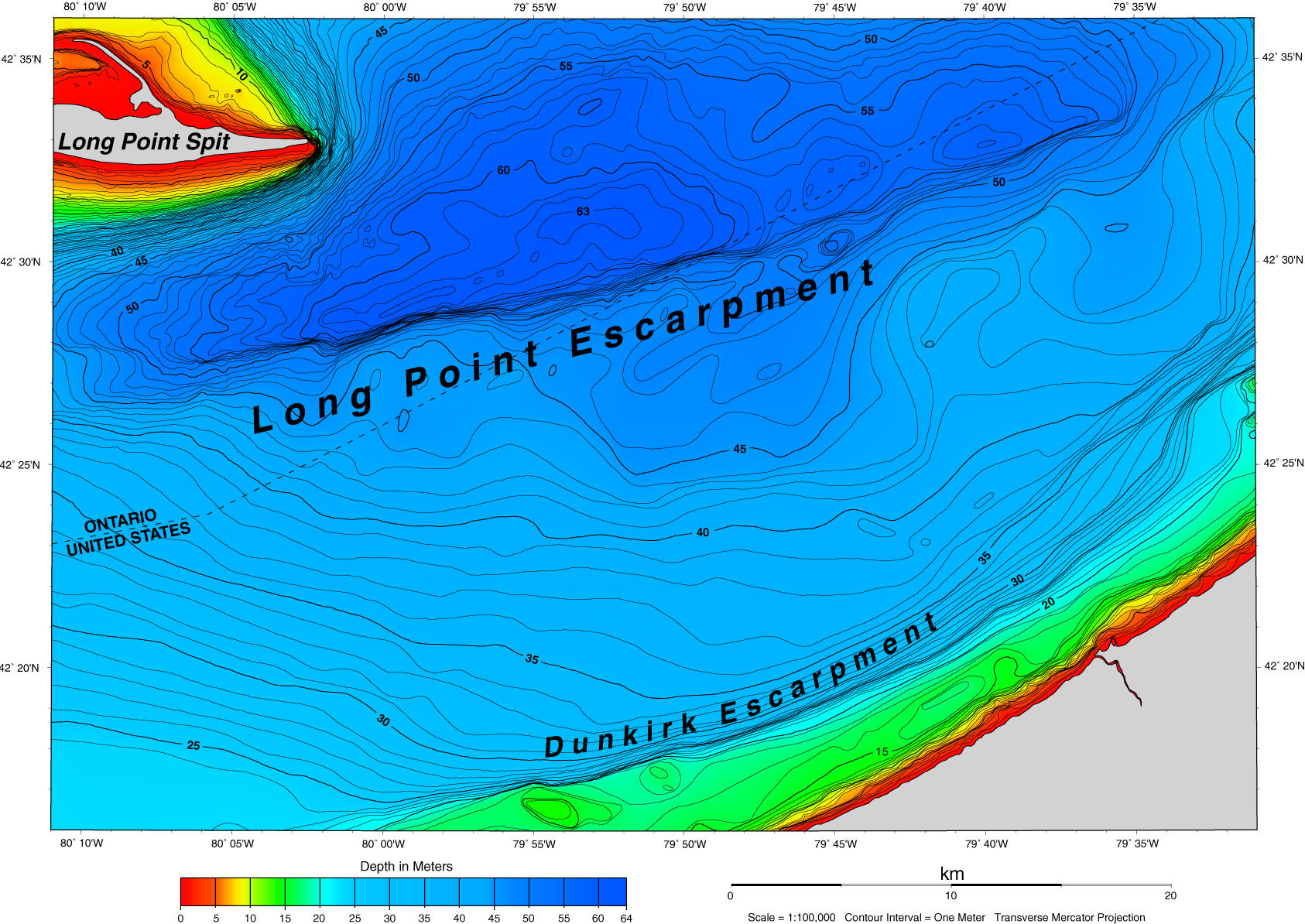
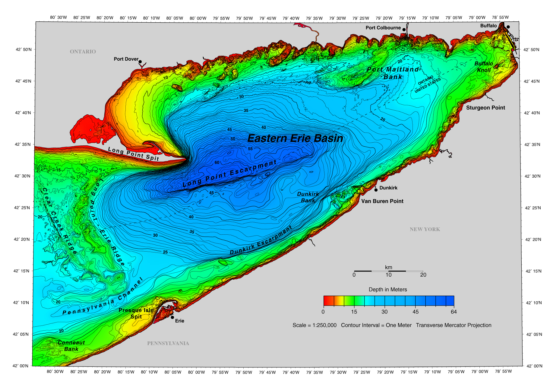
Choose to view a page or full size image for each of the ten areas below.

| Resolution | File Name | Approximate File Size (Kbytes) | Resolution | File Name | Approximate File Size (Kbytes) |
| AREA 1 | AREA 6a | ||||
| Page Size | images/a1_pg.jpg | 82 | Page Size | images/a6a_pg.jpg | 169 |
| Full Size | images/a1.jpg | 1297 | Full Size | images/a6a.jpg | 986 |
| AREA 2 | AREA 6b | ||||
| Page Size | images/a2_pg.jpg | 289 | Page Size | images/a6b_pg.jpg | 232 |
| Full Size | images/a2.jpg | 644 | Full Size | images/a6b.jpg | 1181 |
| AREA 3 | AREA 7 | ||||
| Page Size | images/a3_pg.jpg | 289 | Page Size | images/a7_pg.jpg | 365 |
| Full Size | images/a3.jpg | 1712 | Full Size | images/a7.jpg | 1194 |
| AREA 4 | AREA 8 | ||||
| Page Size | images/a4_pg.jpg | 300 | Page Size | images/a8_pg.jpg | 328 |
| Full Size | images/a4.jpg | 608 | Full Size | images/a8.jpg | 2381 |
| AREA 5 | AREA 9 | ||||
| Page Size | images/a5_pg.jpg | 295 | Page Size | images/a9_pg.jpg | 323 |
| Full Size | images/a5.jpg | 1865 | Full Size | images/a9.jpg | 2076 |
GMT (Generic Mapping Tools) and Adobe Illustrator® were the primary software packages used to create these images.