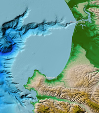
Coastal digital elevation models (DEMs) help researchers and decision makers understand and predict environmental changes that affect coastal regions. DEM data is used in a wide range of critical monitoring activities, including coastal process modeling (tsunami inundation, storm surge, sea-level rise, contaminant dispersal, etc.), ecosystem management, habitat research, coastal and marine spatial planning, hazard mitigation, and community preparedness.

Bathymetric Data Viewer
The Bathymetric Data Viewer is an interactive map application that provides access to a variety bathymetric data, including Coastal DEMs.
Direct Access
Contact
Resources
- Continuously Updated Digital Elevation Models (CUDEMs) to Support Coastal Inundation Modeling (Amante et al.)
- DEM Fact Sheet
- Integrating Bathymetry and Topography to Support Tsunami Modeling and Forecasting
- Accuracy of Interpolated Bathymetry in Digital Elevation Models (Amante and Eakins)
- Estimating Coastal Digital Elevation Model Uncertainty (Amante)
Data Sources
- NOAA National Ocean Service
- U.S. Geological Survey
- U.S. Army Corps of Engineers
- Federal Emergency Management Agency
- Other government agencies, academic institutions, and private companies


