Uses of Hydrographic Survey Data
Data requests are received from various academic, governmental and commercial organizations. The majority of requests are used to populate a data layer within their GIS (Geographic Information System). Data applications are wide spread, examples of previous (National Ocean Service) hydrographic survey data requests are as follows:
General:
- migration and habitat studies of fish and marine mammals
- delineation of bottom features for commercial fishermen
- earthquake and fault studies
- sediment and pollutant studies
- studies of storm surge and tsunami effects
- oil, gas and mineral exploration
- coastal planning and ecosystem evaluations
- color imaging and animation (fly-by)
Specific:
- NOS survey data were provided to produce electronic charting technology for the fishing industry (not navigational use). Real time ocean bottom graphics are displayed via a computer screen during vessel transits. Development of this technology would not be possible without the NOS data.
- NOS survey data were used to generate 3-D images of the bathymetry in Boston Harbor/Massachusetts Bay to show potential site locations for gathering ocean bottom samples.
- NOS survey data were supplied for the purpose of finding potential oil deposits.
- NOS hydrographic survey data were supplied for the Skagway Harbor area in Alaska. Data will be used to produce a plot of the Skagway Harbor before a landslide occurred in 1994, showing a historical "before" picture of the event.
- NOS data were provided to populate a Geographic Information System (GIS) for the San Francisco Bay area. The NOS data will serve a critical function as part of their database system. Without the bathymetry data there would be a significant gap in coverage.
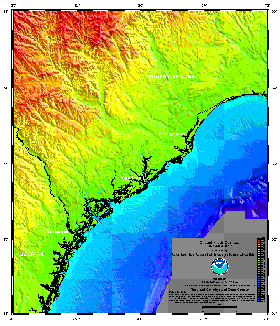
- NOS data are used in producing high resolution color relief image for coastal areas, along with other data sources. Click on the image below to see a more detailed image, or go to
NCEI coastal DEMs.

- NOS survey data were contoured for Lake Michigan and Western Lake Erie. Contours were digitally scanned and images created for both of these lakes.
|