|
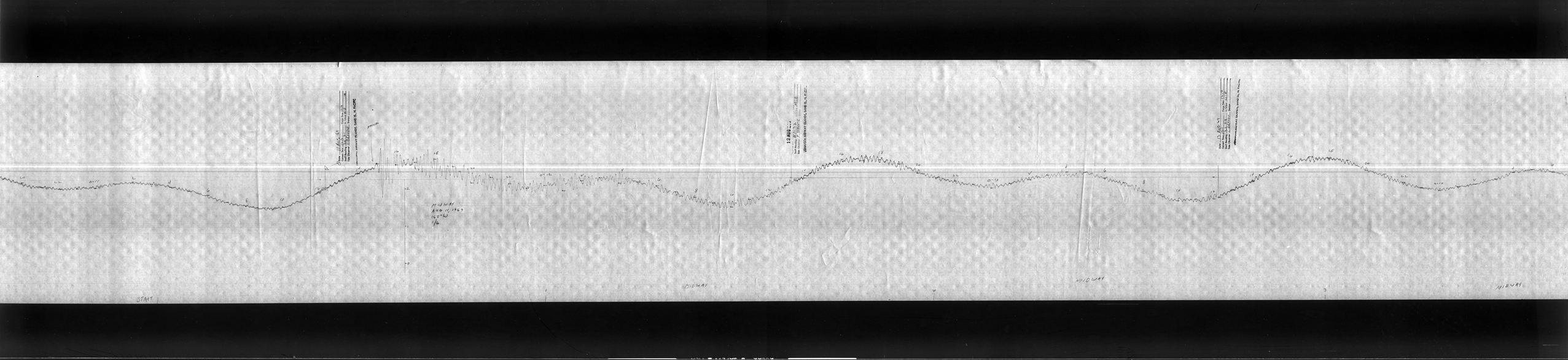
Water Level Data in Support of Tsunami ResearchNCEI is the long-term archive for all NOAA coastal tide gauge data: 1-minute water level data from the NOAA/NOS Center for Operational Oceanographic Products and Services (CO-OPS) and high-resolution water level data from the Pacific Tsunami Warning Center (PTWC), and the National Tsunami Warning Center (NTWC). In 2007, CO-OPS completed upgrades on tide stations in Alaska, the Pacific Islands, the West Coast, and the Caribbean. The upgraded tide stations are equipped with hardware and software to enable the collection and dissemination of 1-minute water level data. Access 1-minute data from the CO-OPS site. Marigrams -- Climate Database Modernization Program (CDMP)NCEI converts tsunami marigrams from analog (microfiche) to high-resolution digital images. Microfiche were created in the 1970s from deteriorating paper records. The project is a multi-year effort, tasked through the Climate Database Modernization Program (CDMP). The collection includes records from 1854 to 1994.
Search the collection and download images for select tsunami events. Contact the data manager for the availability of remaining images that are not online.
Check out our Tsunami Marigram Preservation story map. 
How to CiteCO-OPS 1-minute Water Level Data - Cite as: Center for Operational Oceanographic Products and Services (CO-OPS) (2007): CO-OPS 1-minute Tsunami Water Level Data. NOAA National Centers for Environmental Information. doi:10.7289/V59884XF [access date]. NTWC 15-second Water Level Data - Cite as: National Tsunami Warning Center (NTWC). 2016. Water Level Data from National Tsunami Warning Center Tide Gauges in Alaska and California. NOAA National Centers for Environmental Information. doi: 10.25921/23vy-9z62. Accessed [date]. PTWC 10-second Water Level Data - Cite as: Pacific Tsunami Warning Center (PTWC). 2018. Water Level Data from Pacific Tsunami Warning Center Tide Gauges in Hawaii. NOAA National Centers for Environmental Information. doi:10.25921/mand-3524. Accessed [date]. Marigrams - Cite As: NOAA National Centers for Environmental Information; NCEI: Archival and Discovery of [event YYYY-MM-DD] Tsunami Event on Marigrams. NOAA National Centers for Environmental Information. [access date]. |
Real Time Data & Operators: NOAA
Joint Archive for Sea Level Non-NOAA |