
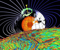
EMAG2 (Earth Magnetic Anomaly Grid 2-arc-minute resolution) is compiled from satellite, ship, and airborne magnetic measurements. Magnetic anomalies result from geologic features enhancing or depressing the local magnetic field. These maps increase knowledge of subsurface structure and composition of the Earth's crust. Global magnetic anomaly grids are used for resource exploration, navigation where GPS is unavailable (submarine, directional drilling, etc.), and studying the evolution of the lithosphere.
Product Details
The latest EMAG2 (v3) includes more than 11.5M new ship and airborne track-line data, and several new or updated precompiled grids. While the previous EMAG2 relied on known or idealized local geology to interpolate anomalies into non-existent data areas, EMAG2 v3 relies solely on the data available. As a result, EMAG2 v3 better represents the complexity of these anomalies (particularly in oceanic regions) and accurately reflects areas where no data have been collected. The current version reports anomalies in two ways: A consistent altitude of 4km (referred to as Upward Continued) Anomaly altitude at Sea Level above oceanic regions and 4km above continental regions (referred to as Sea Level).

Partners
Models are produced through joint research with the Cooperative Institute for Research in Environmental Sciences (CIRES).
| Title | Type | Download / Link | Size | Description |
|---|---|---|---|---|
| EMAG2 v3 Source | ASCII | 4.5 GB | EMAG2_V3 is delivered as a 1.5GB zip file that contains comma delimited data (CSV). The format descriptor is a text file that provides information about the CSV file. | |
| EMAG2v3 Source GeoTIFFs | GeoTIFF* | 175 MB | Values (nT) are stored as 32-bit floating point. The nodata value is 99999. | |
| Color Hillshade Image | GeoTIFF* | 294 MB | A color relief image rendered with a "hillshade" effect to simulate a 3D surface (see: color scale legend). The format is 24-bit RGB GeoTIFF*. | |
| EMAG2 v3 Map | PNG | 20 MB | Maps contain both mercator and polar stereographic projections. | |
| EMAG2 v3 Interactive Map Service | -- | -- | ArcGIS mosaic dataset with EMAG2v3 (Upward Continued) grids. | |
| Google Earth Image | KMZ | 78 MB | KMZ files can be used with the Google Earth application. | |
| ISO Metadata | XML | Includes data citation information, lineage, etc. | ||
| Color-relief Image | GeoTIFF* | 150 MB | A 24-bit RGB GeoTIFF* color-relief visualization of the EMAG2 grid. | |
| Supplemental Information | PNG | 650 KB | The Code Map provides a reference to the primary data source for each cell as described in the Format file above. The Error Map displays the error associated with each grid cell. | |
| Supplemental Information | GeoTIFF* | 850 KB | Values are stored as 16-bit integers. See the above table for the data source code. The error estimate is in nT. | |
| Supplemental Information | TXT | 26 KB | List of public Cruise IDs used in the construction of EMAG2v3. |
* Georeferenced TIFF (GeoTIFF) format can be used in Esri ArcGIS or any other GIS application.
EMAG2 v2
This version (2009) is a significant update over our first global magnetic anomaly grid, EMAG3. It relies on ocean age models to directionally grid anomaly data into areas where no data exists. The grid is reported at an altitude of 4km.
EMAG3
This version (2007) is a 3 arc-minute resolution magnetic anomaly map. It was the NGDC (now NCEI) candidate for the World Digital Magnetic Anomaly Map at 5km altitude.
Global Geomagnetic Map
The global magnetic map illustrates Earth's evolution (plate tectonics and crustal interaction with the deep mantle). Distinct patterns and magnetic signatures are attributed to the formation (seafloor spreading) and destruction (subduction zones) of oceanic crust, and the formation of continental crust by accretion of various terrains to cratonic areas and large scale volcanism (both on continents and oceans).
.")
Features
- Magnetization is weaker at the equator and stronger at high latitudes, reflecting the strength of the ambient geomagnetic field, which induces magnetization in rocks
- Stripes of alternating magnetization in the oceans are due to sea floor spreading and the alternating polarity of the geomagnetic field
- Very old crust (North American Shield, Baltic Shield, Siberian Craton) have the strongest magnetization and are shown as dark shades of purple and blue


